London Localite contains affiliate links and is a member of the Amazon LLC Associates Program. If you make a purchase using one of these links, we may receive compensation at no extra cost to you. Read our disclaimer for more information.
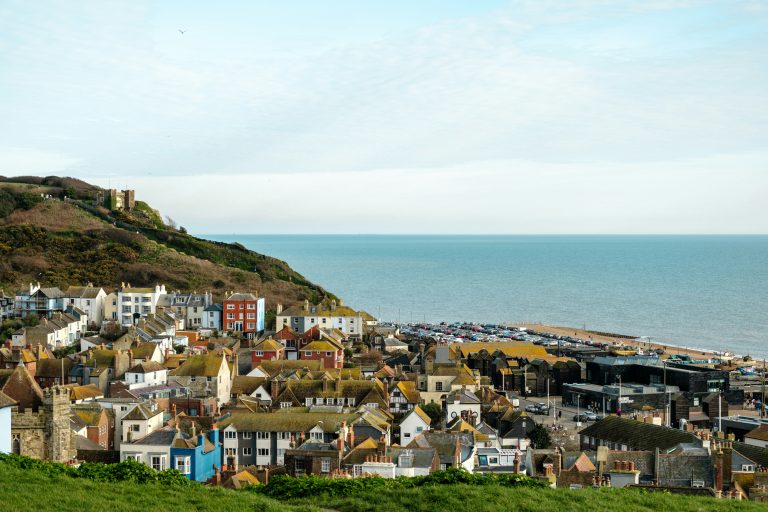
If you’re looking for a coastal walk that combines dramatic cliffs, quiet stretches of beach and charming towns, the Hastings to Rye Walk is hard to beat. Part of the Saxon Shore Way, this route takes you through some seriously beautiful scenery, from the wild clifftops of Hastings Country Park to the historic cobbled streets of Rye.
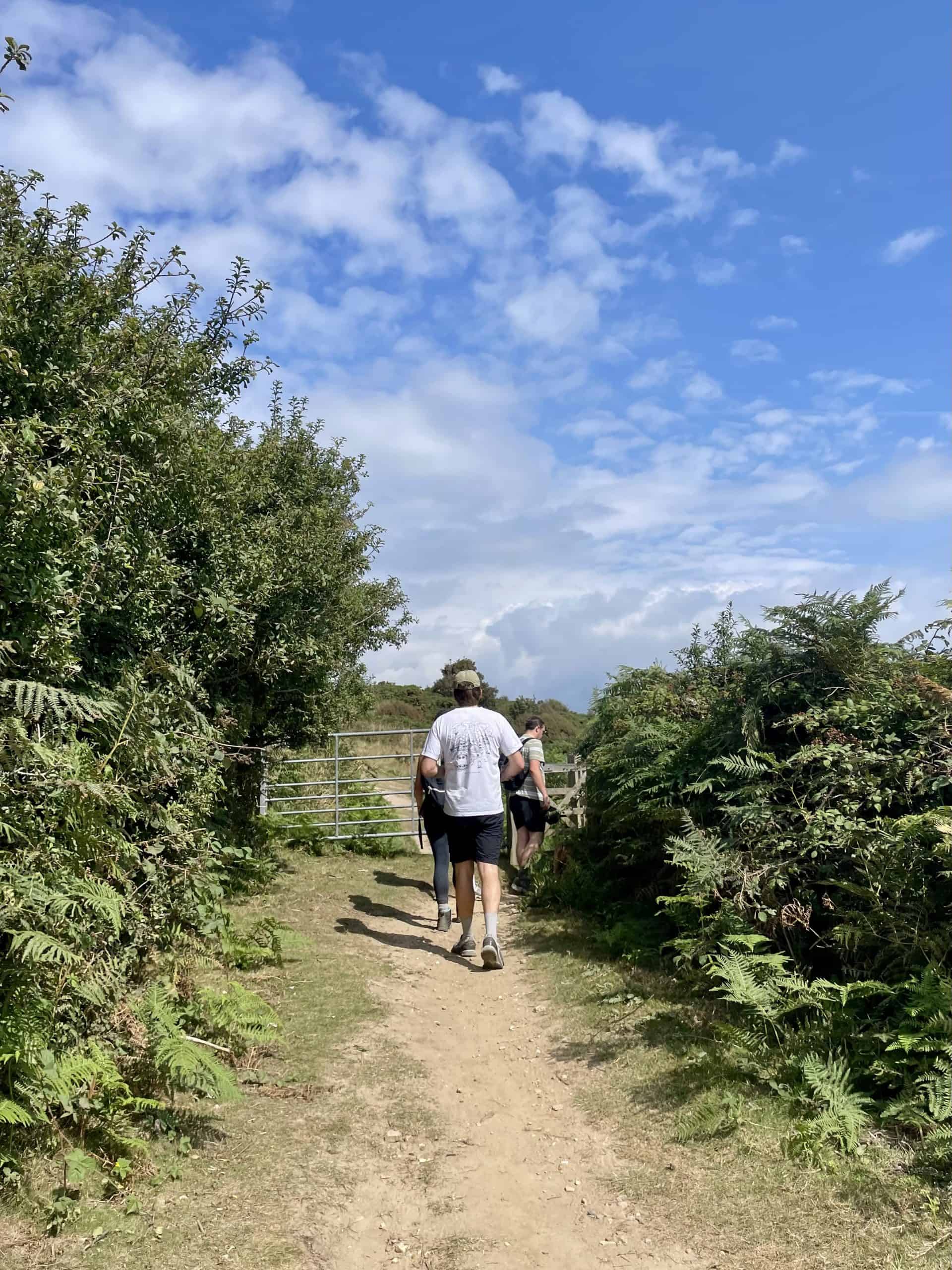
I grew up in Hastings and have walked the first half of this route many times. Then recently, I decided to tackle the full distance to celebrate my 30th birthday with a group of friends.
Below, I’ll cover what to expect on the trail, the best route to take (with a map included) and the ideal time of year to do it. Whether you’re considering the walk as a one-day challenge or as part of a weekend getaway, this post will give you all you need to know before setting off.
Getting to Hastings
The Hastings to Rye Walk is easy to reach from London, with trains from London Bridge and Charing Cross taking around 1 hour 30 minutes. You’ll arrive right in the centre of Hastings, just minutes from the Old Town and the start of the trail.
Getting Back From Rye
The fastest way back to London is from Rye via Ashford International to St Pancras, taking just over an hour. Alternatively, make a weekend of it. Rye is magical once the day-trippers leave, with cobbled streets and cosy pubs to explore. Hastings also makes a brilliant base and trains between Rye and Hastings take about 30 minutes.
Train Tickets & Accommodation!
👉 Trainline is the best place to compare ticket times and prices. Make sure to book your tickets in advance to save money.
👉 I recommend Booking.com to find somewhere to stay. The Old Rectory in Hastings is particularly lovely for a weekend away!
The Hastings to Rye Walk Guide
Now for the fun part – the actual walk itself. Below, I’ll take you step by step through the Hastings to Rye Walk, sharing the exact route we followed, plus a few personal tips and stops along the way to make it even more enjoyable.
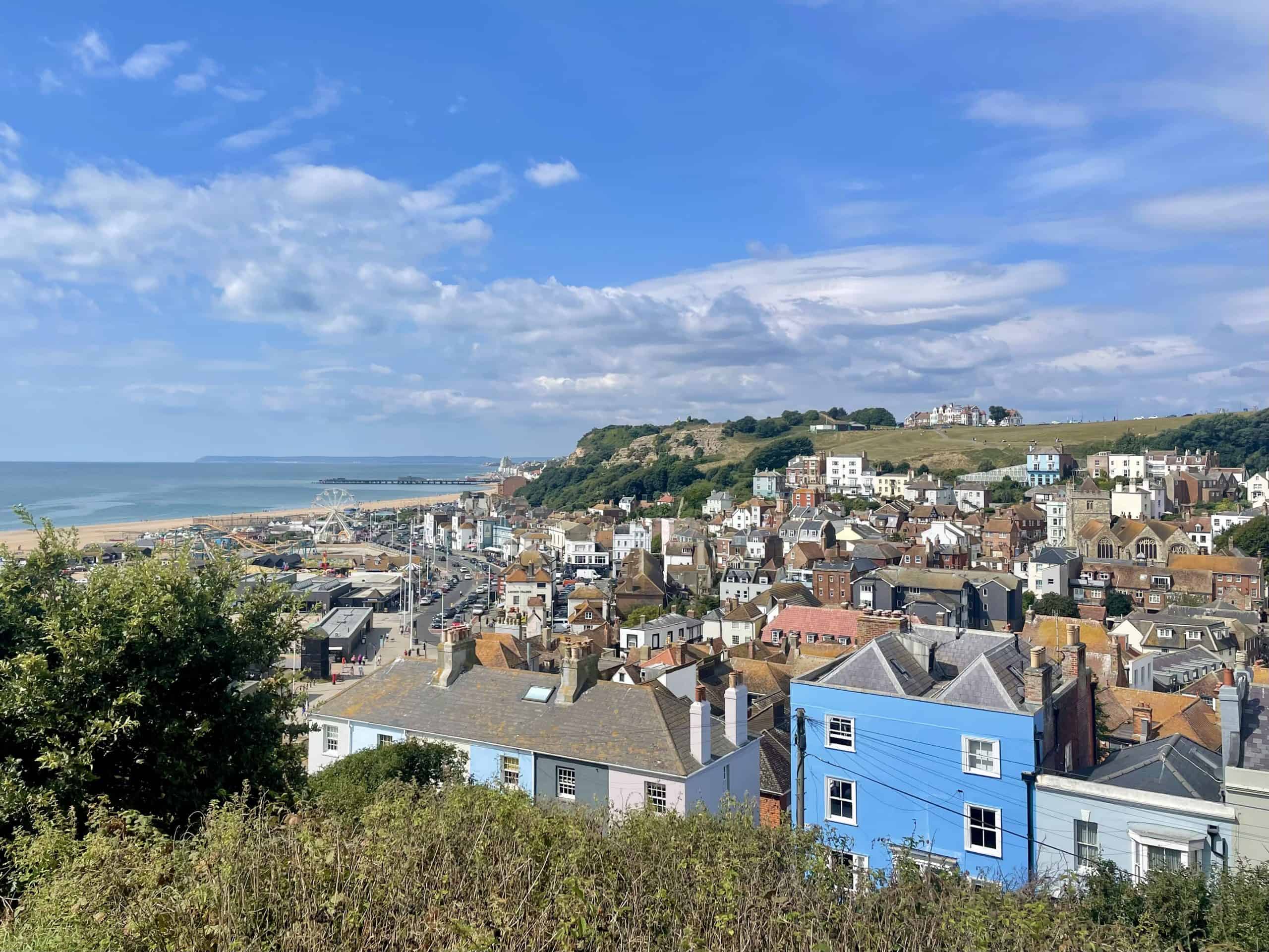
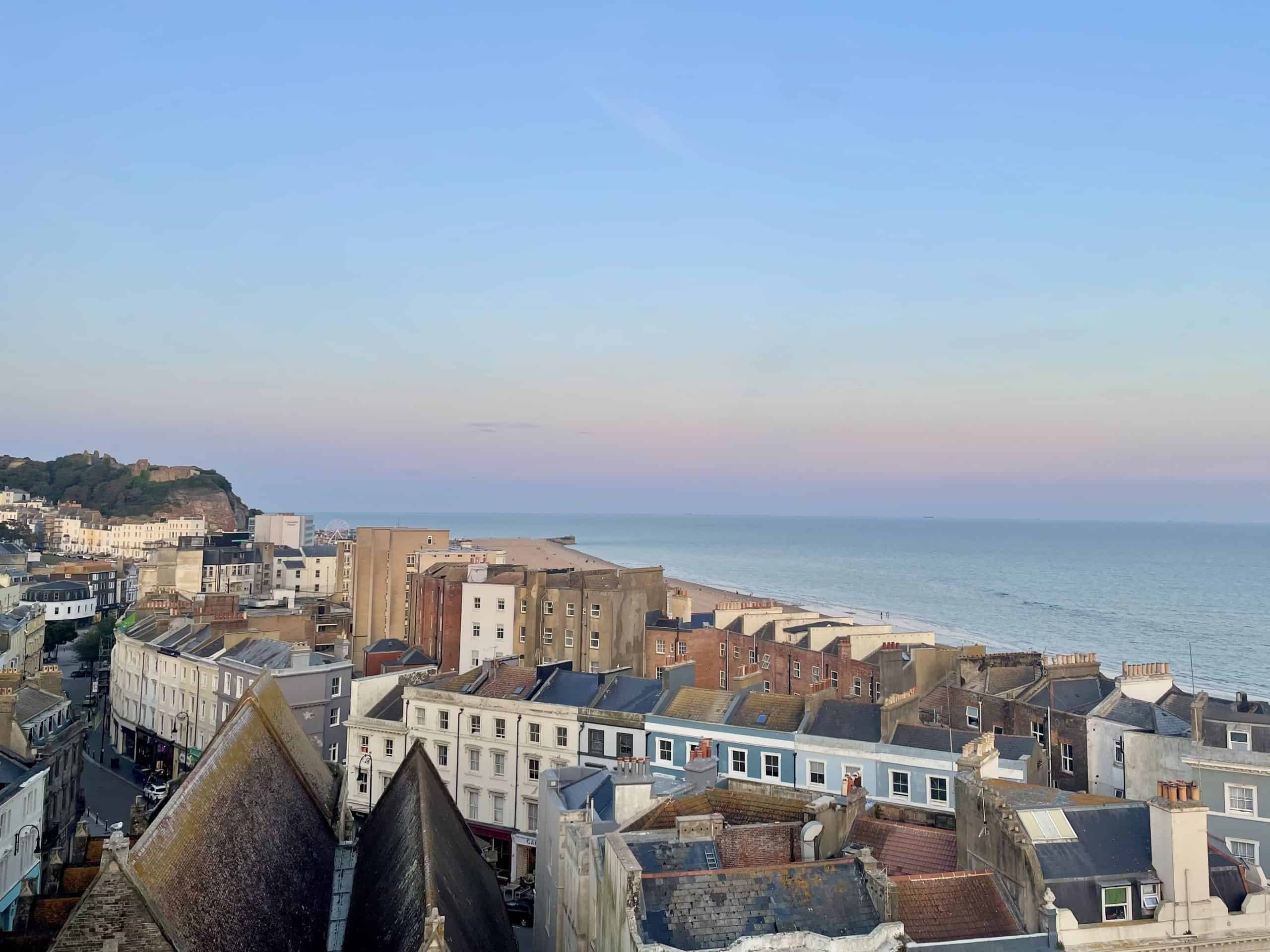
Hastings Old Town
We kicked things off with breakfast at The Pelican, an American-style diner that does brilliant pancakes and fry-ups. It’s the perfect place to fuel up for the day ahead.
From there, the walk begins with the East Hill steps, which you’ll find just up from The Crown pub. It’s a steep climb, but once you’re at the top the views over Hastings and the sea are worth every step. From here, you simply follow the coastline, keeping the sea on your right. Look out for the coastal walk or Saxon Shore Way markers that guide you along the right path.
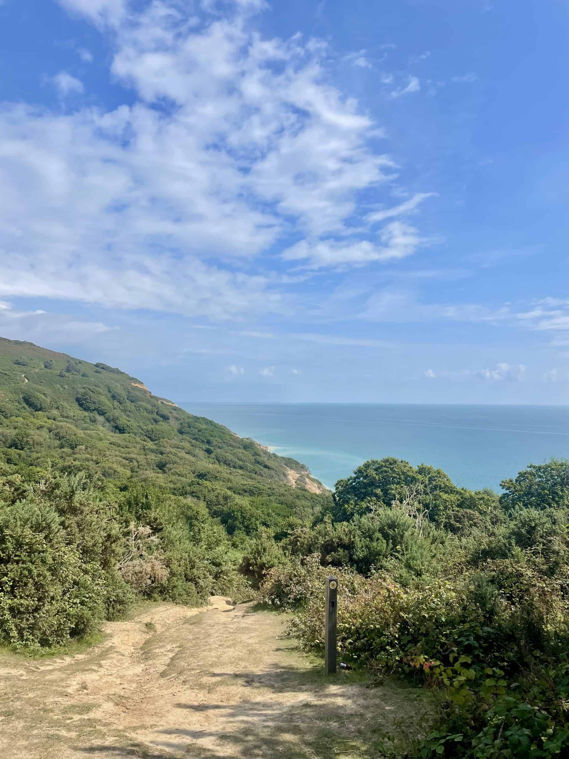
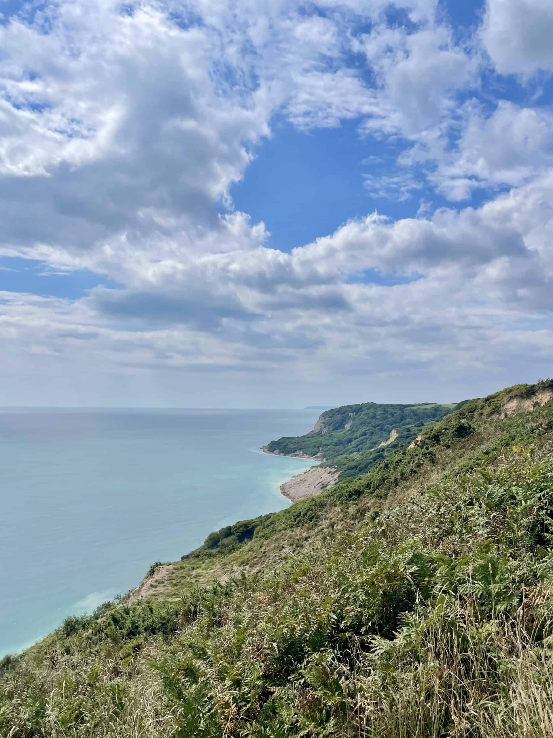
Hastings Country Park
At the top of the East Hill steps, you’ll find Hastings Country Park. The path here is relatively flat but quite exposed. I was definitely grateful for my hat as it was roasting the day we walked. In return, you get sweeping views over the sea and plenty of fresh air.
Along the way, you’ll pass a radar tower, and if you’re lucky, you might spot the Konik horses that are used to keep the gorse under control. A pretty unique sight on an English coastal walk.
The Glens
Next you’ll come to the Glens, my favourite parts of the whole route. This is where the trail gets a little more challenging, with the most ups and downs of the walk. You’ll dip into Ecclesbourne Glen and Fairlight Glen, two deep valleys that take you almost back to sea level before climbing back up.
Parts of this stretch feel quite mystical, with dense woodland and trickling streams that run out to sea. It’s a real contrast to the wide-open clifftops you’ve just left behind.
Fairlight
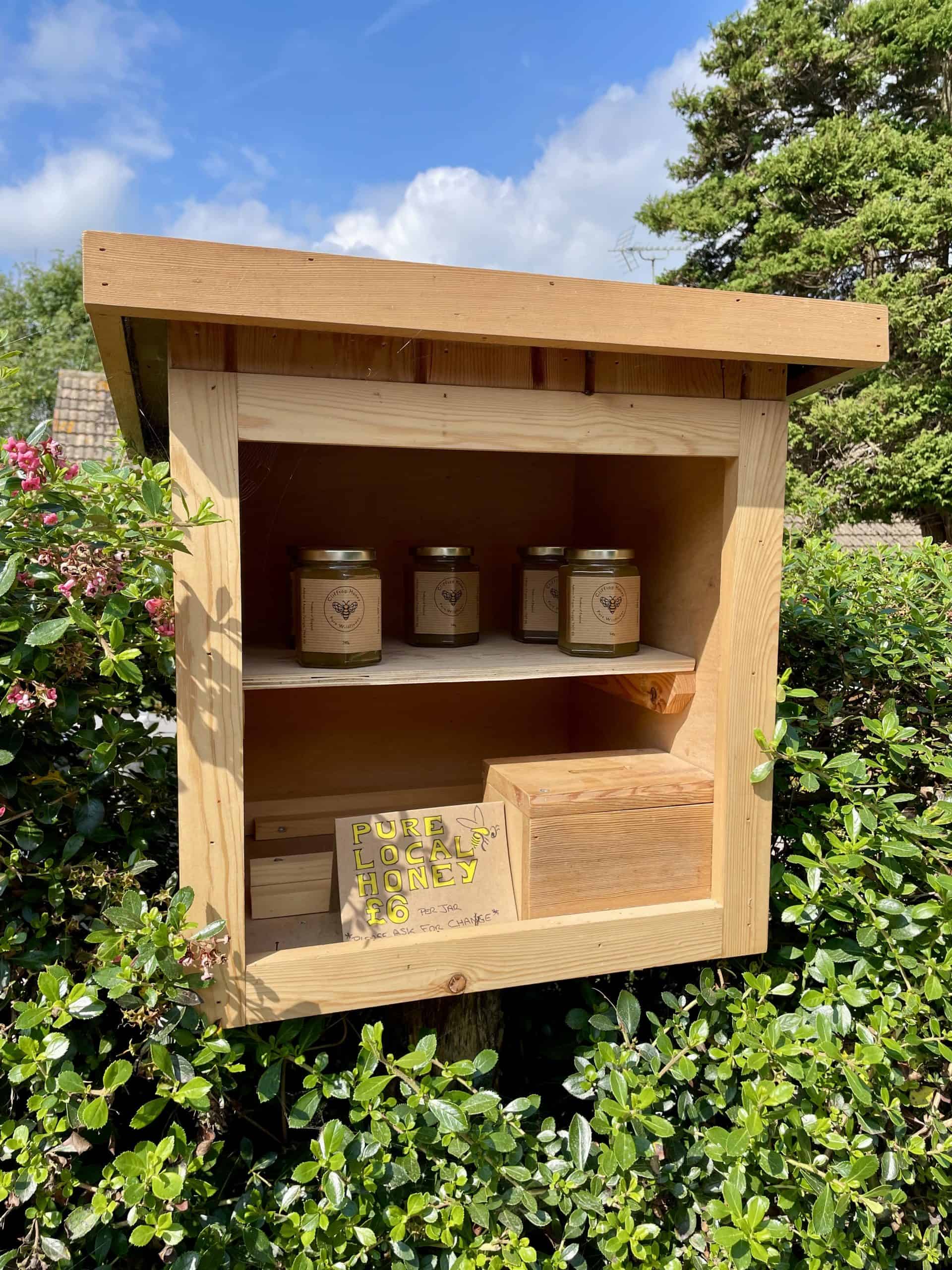
After leaving the Glens behind, the route takes you slightly inland at Fairlight, as parts of the coastal path are closed here. It’s only a short detour, weaving through a quiet residential area. We passed plenty of pretty houses (one even had honey for sale on the doorstep), which made the diversion feel more like a treat than a disruption.
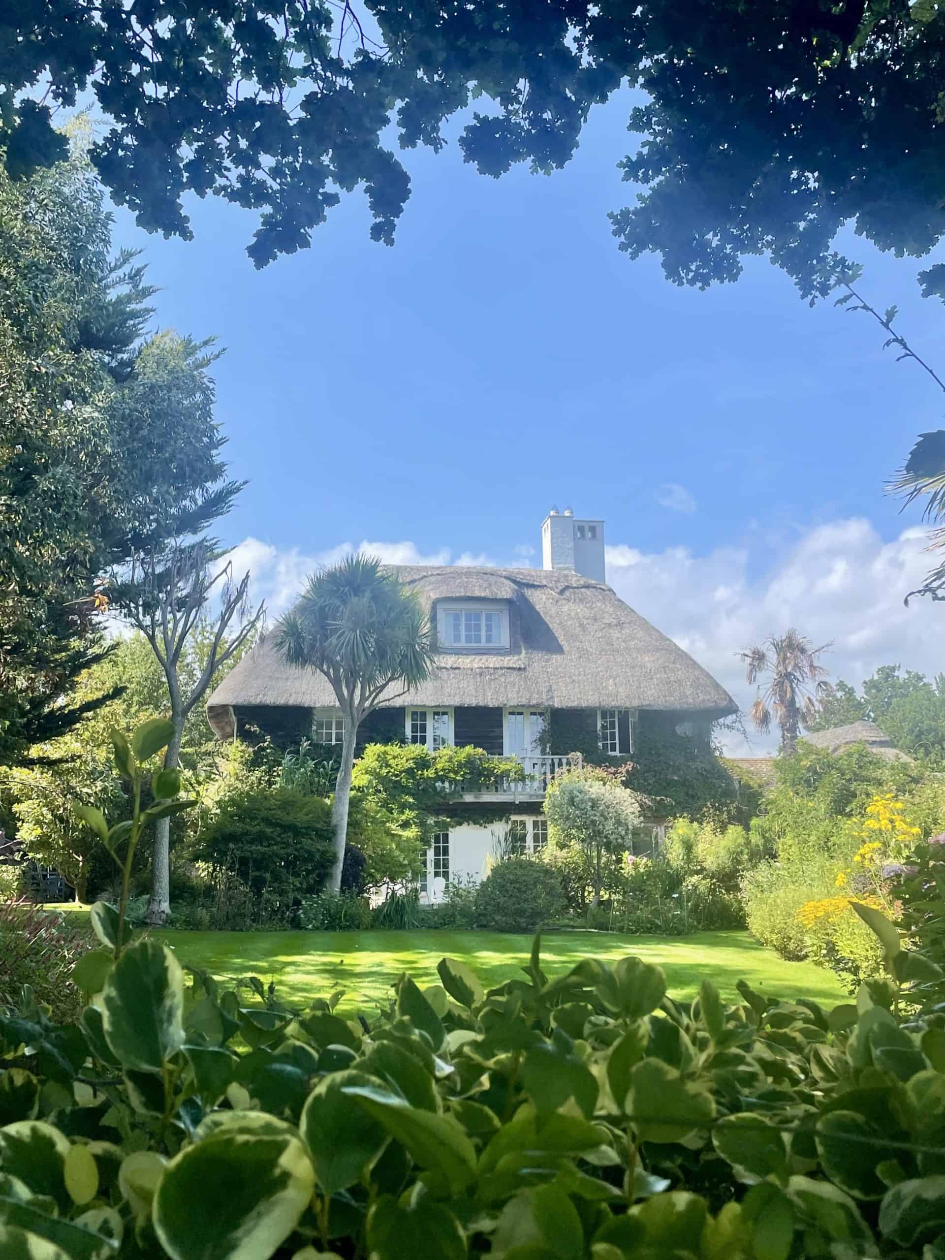
Soon enough, you’re back on the coastal path, surrounded by greenery. This stretch feels a little more secluded. We passed a handful of cottages here too, including what I swear is the most beautiful house I’ve ever seen. The path narrows for a while before opening out onto the road that leads you into Pett Level.
Pett Level
Here you’ll find public toilets and, more importantly, Pett Level Café! The perfect pit stop for snacks, coffee, or even a cold pint – I took advantage of the last option. This is also one of the best spots along the walk for a swim, with a long stretch of pebble beach that’s sandy at low-tide.
From Pett Level, you simply continue along the coast until you reach steps leading back down to the road, where you’ll see signs for the Royal Military Canal.
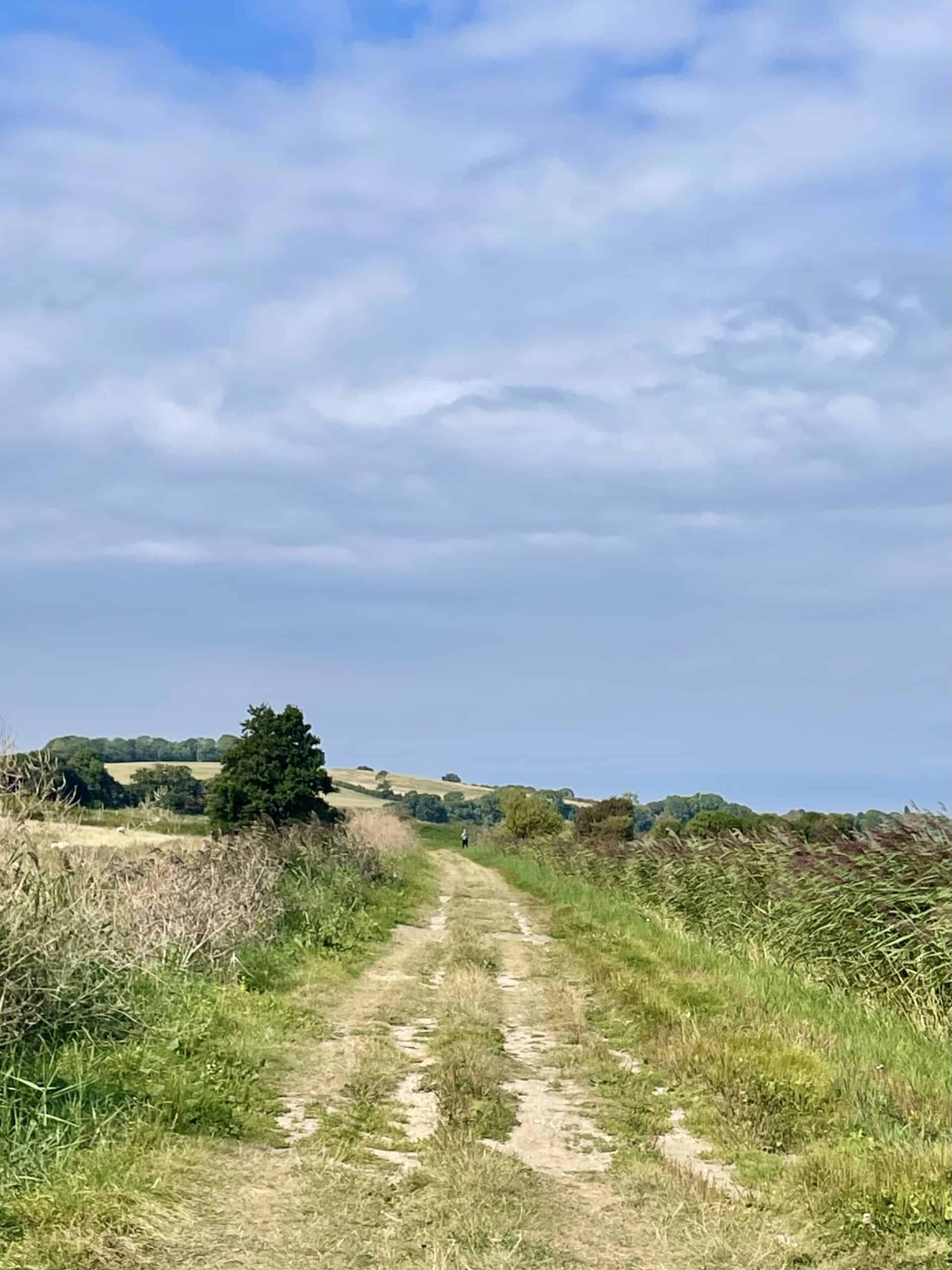
Royal Military Canal & River Brede
The final stretch of the Hastings to Rye Walk flattens out completely, giving your legs a bit of a break after the ups and downs earlier on. From Pett Level, you start following the Royal Military Canal through open fields with views of Winchelsea in the distance. It’s a peaceful section, with wide skies and plenty of birdlife.
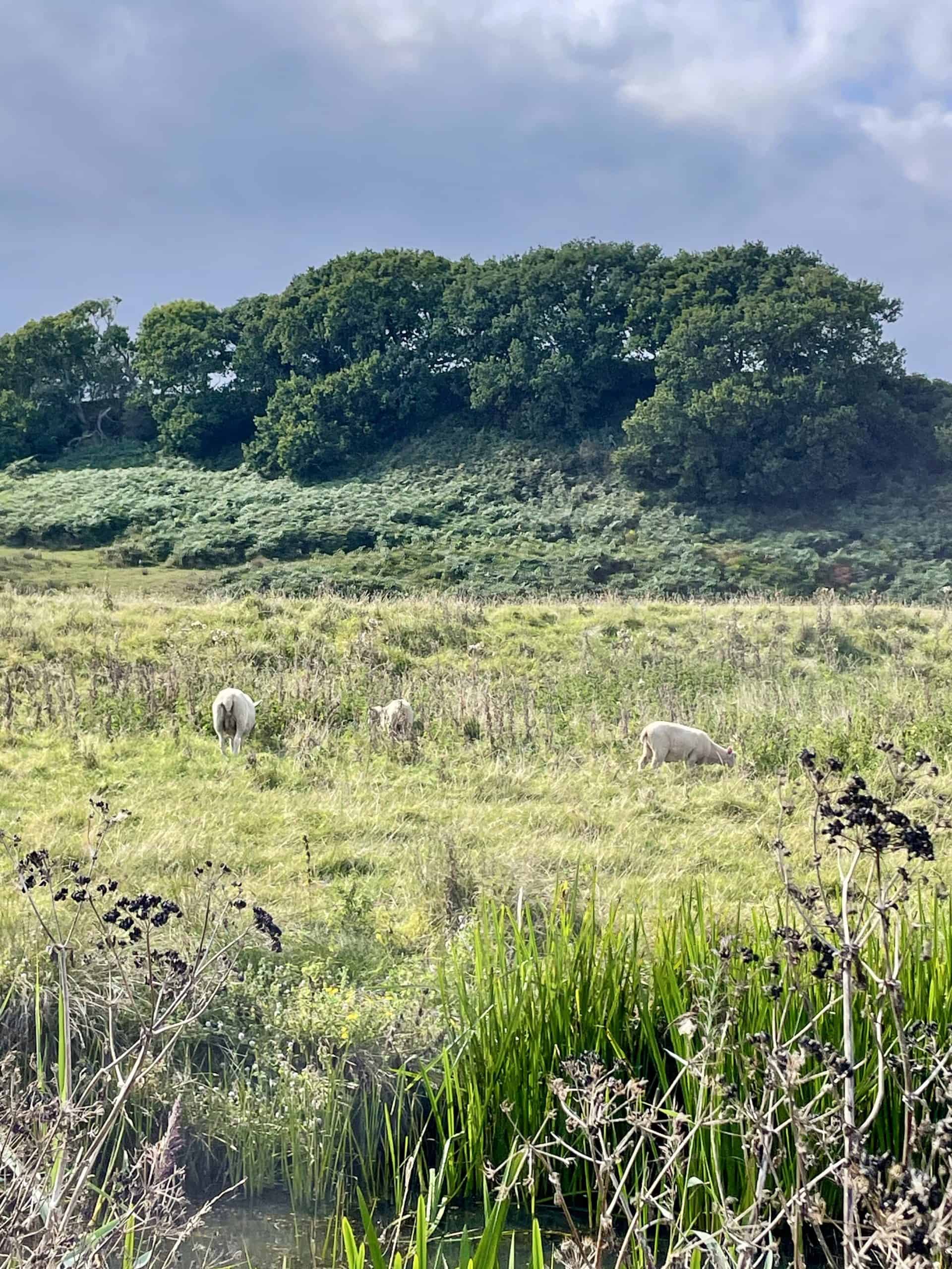
At one point, you’ll need to leave the canal and loop around until you join the River Brede. That linking stretch is probably the least scenic part of the whole walk, as it runs beside a road. Luckily, it’s short-lived and quickly forgotten once you’re passing Camber Castle and fields of friendly sheep (expect a few curious stares as you go by).
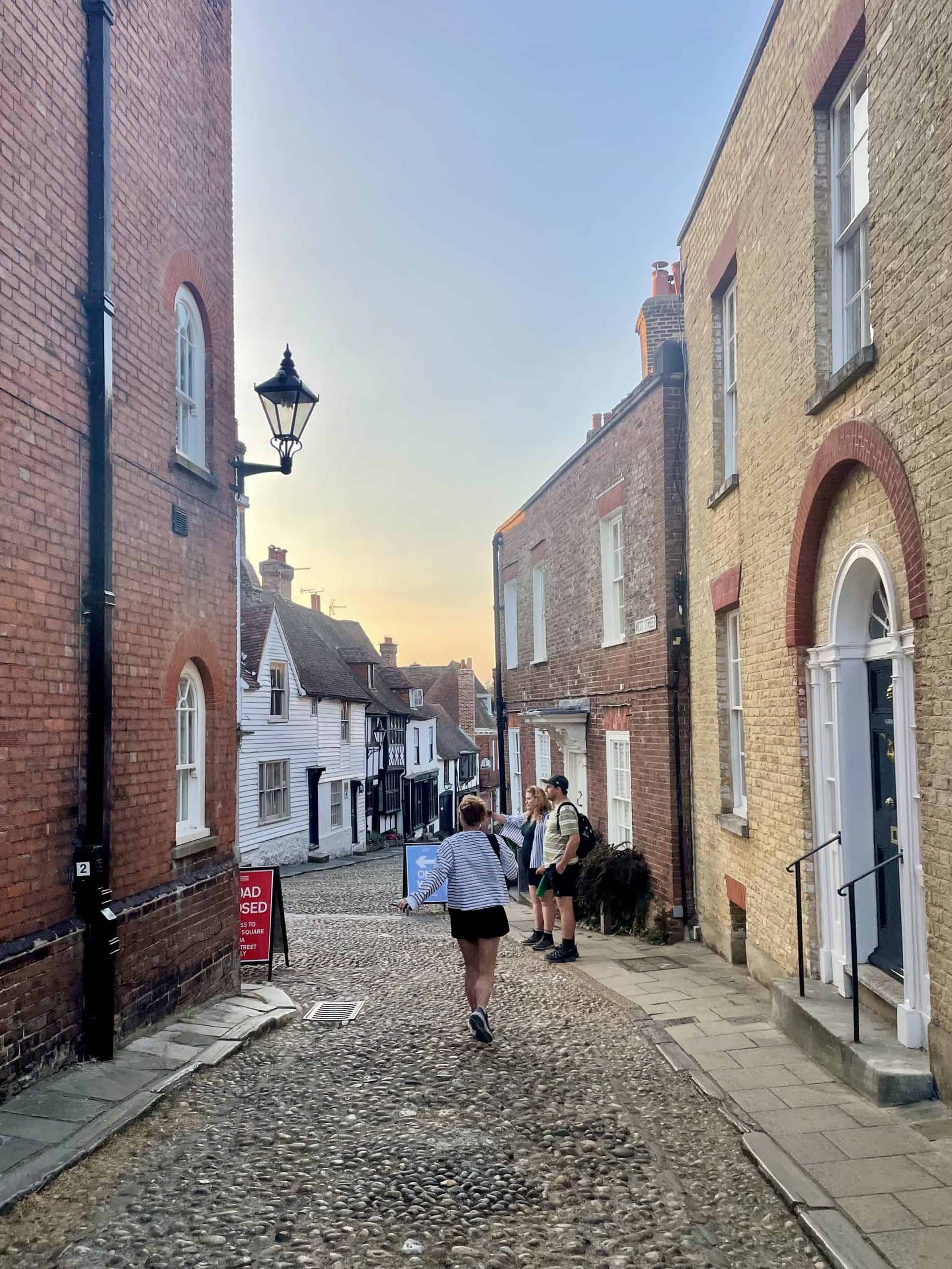
Arriving in Rye
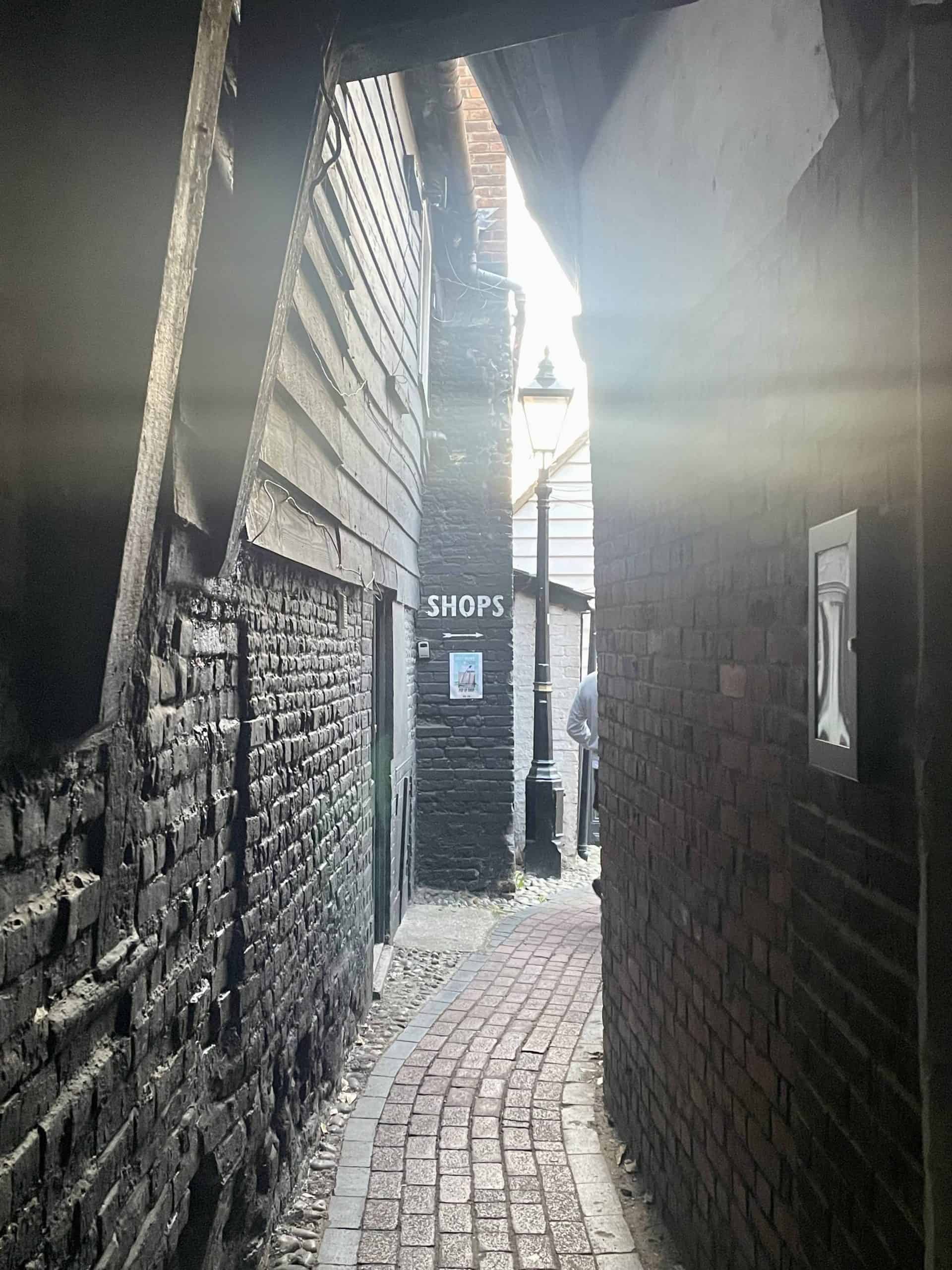
Finally, you make it to Rye and what a beautiful finish it is. This medieval town is ridiculously pretty, with cobbled lanes, Tudor houses, and viewpoints that make you feel like you’ve stepped back in time. I’d definitely recommend planning a couple of hours here so you can have a wander.
After a long walk, a celebratory pint is low-key essential. We headed straight to the Ypres Castle Inn, a historic pub tucked right by the castle walls. It’s got a big garden that’s perfect on a sunny afternoon, and it’s exactly the kind of spot you’ll want to toast the end of your walk in.
Alternative Hastings to Rye Route
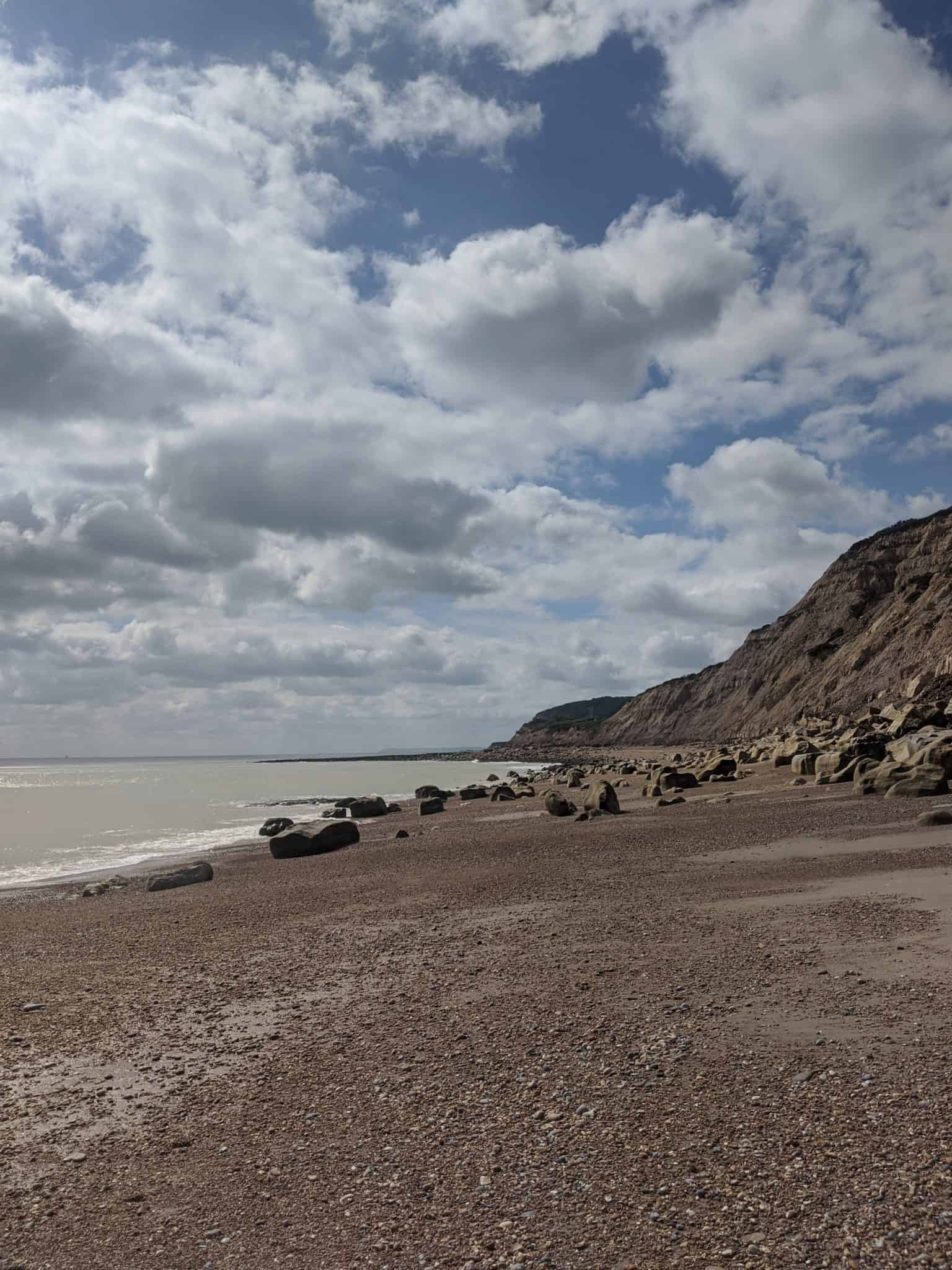
The first time I tackled the Hastings to Rye Walk, I actually skipped the clifftop section and reached Pett Level via the beach instead. To do this, you must check the tide times carefully. When the tide is in, there’s no beach to walk on, and rockfalls are a real risk in certain areas.
That said, if you can time it right, it’s spectacular. The beach is wonderfully remote and feels more adventurous than the main trail. Because it’s so secluded, there’s also the chance of spotting seals. I actually swam with them once, which was an unforgettable experience.
Hastings to Rye Route Map
To help you plan your walk, here are links to both Google Maps and Strava routes. These show the exact path I followed. One of us had an All Trails app and subscription, which came in very handy as I hadn’t saved the Google Maps route to my phone. However, there’s a signal the whole way, so either way, you’ll be fine.
Gear You’ll Need for the Walk
The Hastings to Rye Walk is around 20km, so it’s not one to head out on unprepared. While it’s straightforward in terms of navigation, there are a few essentials that will make the day much more enjoyable:
- Decent walking shoes – Parts of Hastings Country Park are steep with plenty of ups and downs. In summer, the paths can get dry and dusty, so shoes with good grip are a must.
- Swimming costume + towel – If you fancy a dip at Pett Level (or even Camber Sands at the end), pack swimwear so you don’t miss the chance.
- Plenty of water – It’s a long walk with very few places to refill, so bring more than you think you’ll need.
- Snacks or a packed lunch – There are a couple of cafés along the way, but you’ll want something on hand to keep you going between stops.
- Sun protection – A hat, sunglasses, and sunscreen are essentials, especially on the exposed cliff sections.
FAQs
Have questions about the Hastings to Rye Walk? Here are a couple of the things I wondered myself before setting off, plus my honest answers now that I’ve done it.
1. How long does it take to walk from Hastings to Rye?
It took us 4 hours 29 minutes of moving time, but with breaks included it was just under 6 hours. We stopped at Pett Level for a well-earned pint, and we also had an older dog with us for the first section, who needed a few rests!
2. When is the best time of year to walk from Hastings to Rye?
I’d recommend doing the walk in summer or autumn, as long as it’s not during a heatwave. The exposed clifftops are much more enjoyable in warm weather, and Pett Level is a great spot for a swim if it’s sunny. I wouldn’t go after heavy rain as the Glens get VERY muddy.
3. Is the Hastings to Rye Walk hard?
It’s moderate… There are steep climbs and descents in Hastings Country Park and the Glens, but after Pett Level, the terrain flattens out. Decent walking shoes are a must.
4. Why is it called Saxon Shore Way?
The Saxon Shore Way takes its name from the “Saxon Shore,” a line of Roman forts built along the south-east coast of England in the 3rd and 4th centuries AD. These defences were designed to protect against raiders invading from Europe.
Round up: What to Expect from the Hastings to Rye Coastal Walk
Hopefully, this guide has helped you plan your coastal adventure. It’s a stunning trail and, done as part of a weekend in Hastings, it makes for a perfect escape from London. Both Rye and Hastings are gorgeous, and the coastline between them is equally as special.
I’d love to do the walk again, but next time I think I’ll start in Rye and head towards Hastings. The tougher climbs would come at the end, but it would be lovely to see the views from the other direction.